

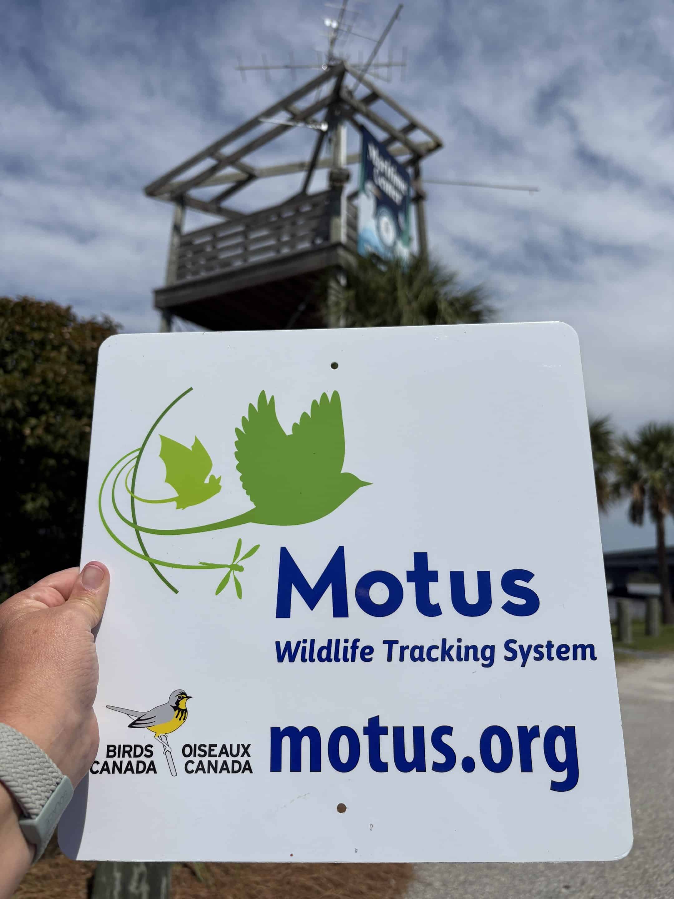
You might be familiar with the iconic tower that looms over the bottom of the bridge heading South from Lemon Island, inviting cars to stop and explore the Maritime Center. Have you ever noticed the series of antennae at the top of that tower? Believe it or not, those antennae are part of the Motus network – a global tracking network that monitors and records the movement of highly mobile species. And our Motus station at PRSF just got an upgrade to more powerful and accurate technology!
Motus is Latin for movement, referring to the goal of tracking migratory species worldwide. While the original goal of the Motus network was to understand the flyways and movements of migratory bird species, the same system has proven helpful for studying bats, insects, and reptiles. This growing network is helping us identify movement corridors throughout the state and pinpoint areas of greatest conservation value.
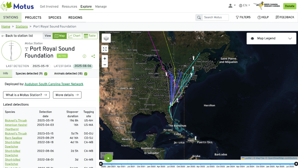
Around the world, there are 2,216 stations set up and tracking in 34 countries. In South Carolina, we have 32 stations with the majority located along the coast and several that transect inland. This effort is primarily led by Audubon SC, with a range of collaborative partners, including PRSF and the Nemours Wildlife Foundation.
How are animals tagged and tracked?
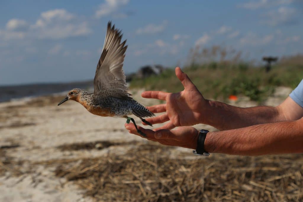
For an animal to be detected by the Motus station, it must have an electronic tag attached to its body. Different tracking technologies have been used over time, and currently, CTT (Cellular Tracking Technology) trackers are the most widely used. Weighing in at .06 grams, these non-invasive trackers attach to the back of animals (imagine a tiny backpack) that sends a signal with unique individualized codes to any tower it passes. These communication pings allow the path of that animal to be followed. A single red knot, tagged on Fripp Island, pinged 10 stations over the course of the year, allowing its path to be traced 4,000 miles from the Palmetto State to the upper reaches of Hudson Bay in northeastern Canada.
Why is understanding population movements important for conservation?
When we are talking more specifically about tracking birds, they do something that most animals cannot — fly. And they can fly pretty far! Some species may hang out in your backyard year-round. Still, others embark on annual migrations – seasonal journeys of hundreds or thousands of miles each year to find suitable habitats, food resources, and mates, among other things. Migration pathways and patterns for different bird species have been somewhat challenging to determine, which is why the global Motus network provides a valuable source of information for a better understanding of bird migration.
Birds of prey, also known as raptors, migrate from North America to South America, utilizing atmospheric thermals in conjunction with soaring to maximize their energy. Songbirds (i.e., hummingbirds and warblers) and shorebirds (i.e., red knots and whimbrels), on the other hand, will cross large bodies of water such as the Gulf of Mexico on their migration routes. Birds use cues such as the amount of daylight, weather, and indeed other unknown variables to guide their journey. Some species stop to eat and rest, while others fly nonstop from start to stop. Some individuals prefer specific flight routes (which may still be disrupted by weather), while others opt for the path of least resistance.
Ultimately, migration is a complex and vulnerable process. Loss of critical habitats, human interference such as light pollution, and changing seasonal patterns resulting from climate change have added more complexity. Every bird (or any animal) that pings a Motus tower provides a data point that helps us better understand where animals are coming from, where they are headed, and is contributing to the solution of the complex puzzle of animal migration.
What other species can be tracked with Motus technology?
The technology that powers the Motus stations is continually evolving, enabling it to track a wide range of animal movements, including bats, insects, small mammals, reptiles, etc. Here in the Port Royal Sound watershed, a collaborative group of researchers is exploring the use of Motus technology to track reptile species, specifically the eastern diamondback terrapin and rattlesnakes.
Little is known about how these charismatic species traverse the marshes and sea islands, and Motus tracking technology may provide some more answers. Researchers plan to utilize the current network of Motus towers in the Beaufort area, coupled with smaller arrays of tracking technology to pinpoint the movement of these cryptic species.
How can you participate in tracking species?
Motus stations provide one data source for understanding the movement of species in the area, but that data becomes much more valuable when it’s corroborated with other sources. Some interesting and helpful citizen science tools and projects collect and provide useful information to paint a more detailed picture of biodiversity in a given place. A few we use at the Port Royal Sound Foundation include iNaturalist, eBird, and HerpMapper. They offer great ways for nature enthusiasts to inform state, local, and national research about the presence and abundance of species in an area. Understanding the health of populations, as well as the presence and absence of rare species in your area, can lead to more effective conservation initiatives.